Tour du Valat
Tour du Valat
  • Navigation access
  • Content access
  • Footer access
  • Adopt a flamingo
  • Documentary portal
  • Search
  • fr
  • en
  • The Tour du Valat
    • History and values
    • The estate
    • Our team
    • Organisation chart and CVs
    • Governance and budget
    • Partners and sponsors
    • Visiting the Tour du Valat
  • Mediterranean wetlands
    • Types of Mediterranean wetlands
    • Threats, issues and protection
    • Spotlight on the Camargue
    • The Mediterranean Alliance for Wetlands
    • The Mediterranean Wetlands Observatory
  • Our actions
  • Media
    • The Library
    • Recent publications
    • Activity reports
    • The HAL portal
    • Books, booklets and reports
    • Institutionnal documents
    • Photo gallery
    • Videos
  • News
  • Support us
    • Adopt a Flamingo
    • Make a contribution
    • Make a donation or bequest
  • Navigation access
  • Content access
  • Footer access
  • Adopt a flamingo
  • Documentary portal
  • Search
  • fr
  • en
Tour du Valat
  • The Tour du Valat
    • History and values
    • The estate
    • Our team
    • Organisation chart and CVs
    • Governance and budget
    • Partners and sponsors
    • Visiting the Tour du Valat
  • Mediterranean wetlands
    • Types of Mediterranean wetlands
    • Threats, issues and protection
    • Spotlight on the Camargue
    • The Mediterranean Alliance for Wetlands
    • The Mediterranean Wetlands Observatory
  • Our actions
  • Media
    • The Library
    • Recent publications
    • Activity reports
    • The HAL portal
    • Books, booklets and reports
    • Institutionnal documents
    • Photo gallery
    • Videos
  • News
  • Support us
    • Adopt a Flamingo
    • Make a contribution
    • Make a donation or bequest
Research institute for the conservation of Mediterranean wetlands
  • Home
  • News
  • Publications
  • New article – Introducing WIW for Detecting the Presence of Water in Wetlands with LAndsat and Sentinel Satellites
Back to News
  • A- Switch to smaller font size
  • A+ Switch to biggest font size
  • Print
  • Share
  • RSS
Publications Camargue, France, Mediterranean • Published on 22 October 2019

New article – Introducing WIW for Detecting the Presence of Water in Wetlands with LAndsat and Sentinel Satellites

Click to enlarge

This article was published in the Remote sensing journal in September 2019.

Abstract :

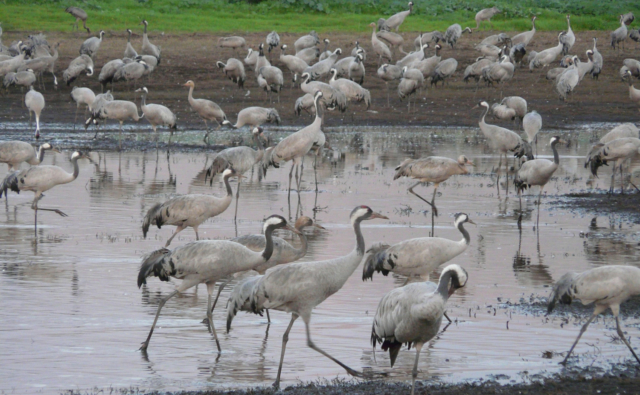
Many wetlands are characterized by a vegetation cover of variable height and density over time. Tracking spatio-temporal changes in inundation patterns of these wetlands remains a challenge for remote sensing.

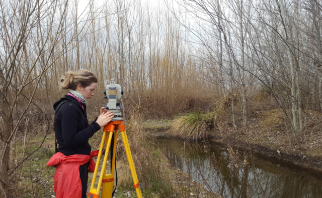
Water In Wetlands (WIW) was predicted using a dichotomous partitioning of reflectance values encoded based on ground-truth (n = 4038) and optical-space derived (n = 7016) data covering all land cover types (n = 17) found in the Rh ô ne delta, southern France.

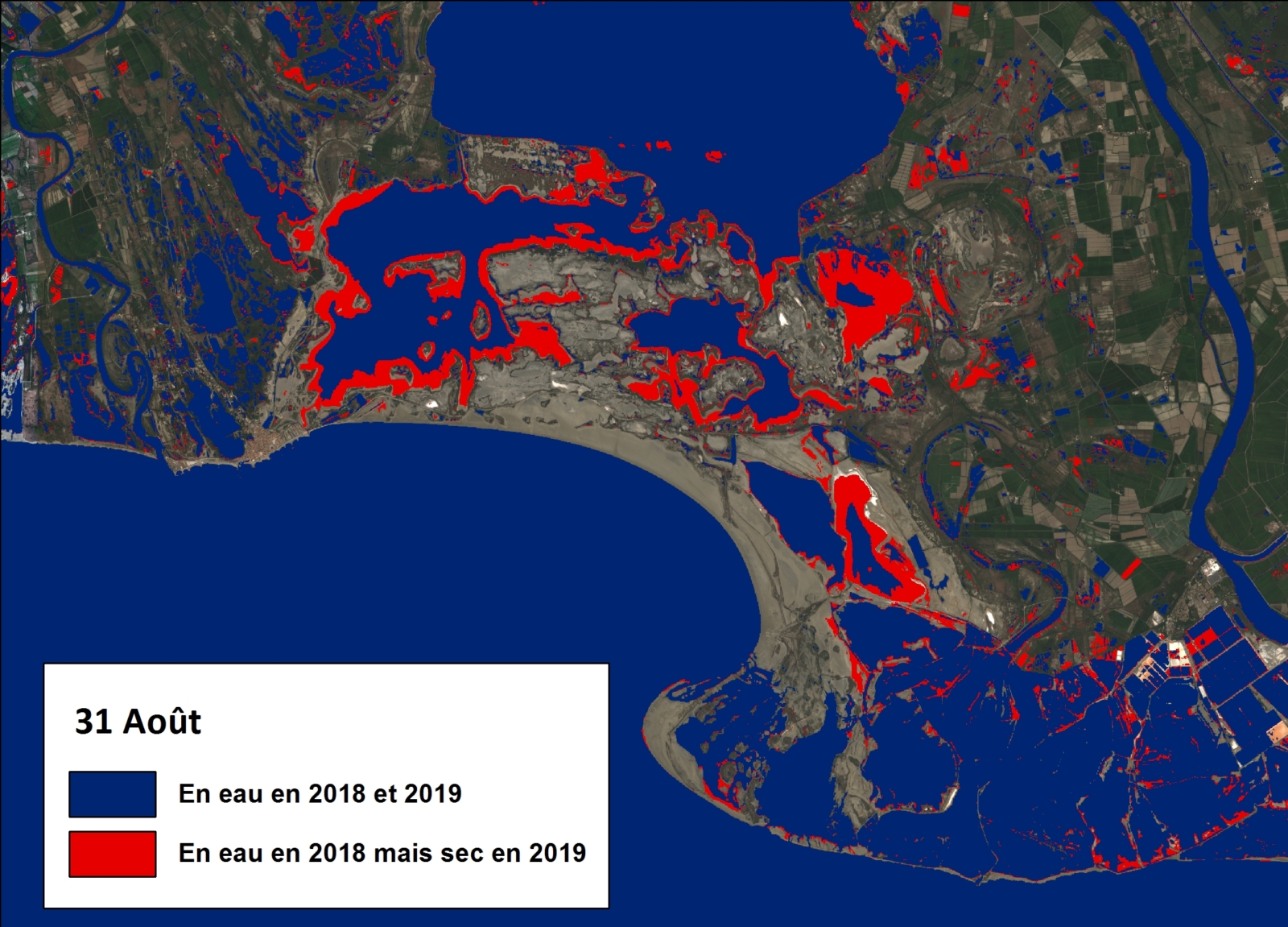
The models were developed with spectral data from Sentinel 2, Landsat 7, and Landsat 8 sensors, hence providing a monitoring tool that covers a 35-year period (same sensor for Landsat 5 and 7). A single model combining the near infrared (NIR ≤ 0.1558 to 0.1804, depending on sensors) and short-wave infrared (SWIR2 ≤ 0.0871 to 0.1131) wavelengths was identified by three independent analyses, each one using a different satellite. Overall accuracy of water maps ranged from 89% to 94% for the training samples and from 90% to 94% for the validation samples, encompassing standard water indices that systematically underestimate flooding duration under vegetation cover. Sentinel 2 provided the highest performance with a kappa coefficient of 0.82 for both samples.

Such tool will be most useful for monitoring the water dynamics of seasonal wetlands, which are particularly sensitive to climate change while providing multiple services to humankind. Considering the high temporal resolution of Sentinel 2 (every 5 days), cumulative water maps built with the WIW logical rule could further be used for mapping a wide range of wetlands which are either periodically or permanently flooded.

You can access it on the Tour du Valat documentary web portal here.

Bibliographical reference: Lefebvre, Davranche, Willm, Campagna, Redmond, Merle, Guelmami, Poulin. 2019. Introducing WIW for Detecting the Presence of Water in Wetlands with Landsat and Sentinel Satellites. Remote Sensing 11:2210. doi: 10.3390/rs11192210

Newsletter

Keep up with Tour du Valat news:
Show previous newsletters
News Archives
  • 2025
  • 2024
  • 2023
  • 2022
  • 2021
  • 2020
  • 2019
  • 2018
  • 2017
  • 2016
  • 2015
  • 2014
  • 2013
Agenda Archives
  • 2024
  • 2023
  • 2022
  • 2021
  • 2020
  • 2019
  • 2018
  • 2017
  • 2016
  • 2015
  • 2014
  • 2013

Related
projects

All projects
Ongoing project
Management and restoration of Natural and Agricultural ecosystems

Nesting boxes and roosts to make the agricultural landscape more hospitable to birds and bats

Camargue
Ongoing project
Science-Society Interfaces

Mediterranean Waterbird Network (MWN)

Albania, Algeria, Camargue, Egypt, France, Greece, Italia, Libya, Macedonia, Mediterranean, Morocco, Portugal, Spain, Tunisia, Turkey • 2012
Completed project

Ecosystem services provided by Mediterranean wetlands

Mediterranean • 2008
Ongoing project
Species Conservation

Population dynamics of the Glossy Ibis

Camargue, France, Spain • 2006
Tour du Valat
Tour du Valat

Le Sambuc - 13200 Arles
France

Phone : +33 (0)4 90 97 20 13

[email protected]


Contact
  • Practical information
    • Calendar
    • Past events
    • Vacancies
    • Interactive map
    • Logo & access map
  • Legal information
    • Legal notice
    • Cookie policy (EU)
  • Linkedin
  • Facebook
  • Vimeo
  • RSS
Gérer le consentement aux cookies
We use cookies to enhance your experience on our web site.
Functional Always active
The technical storage or access is strictly necessary for the legitimate purpose of enabling the use of a specific service explicitly requested by the subscriber or user, or for the sole purpose of carrying out the transmission of a communication over an electronic communications network.
Settings
Le stockage ou l’accès technique est nécessaire dans la finalité d’intérêt légitime de stocker des préférences qui ne sont pas demandées par l’abonné ou l’utilisateur.
Statistics
The technical storage or access that is used exclusively for statistical purposes. Le stockage ou l’accès technique qui est utilisé exclusivement dans des finalités statistiques anonymes. En l’absence d’une assignation à comparaître, d’une conformité volontaire de la part de votre fournisseur d’accès à internet ou d’enregistrements supplémentaires provenant d’une tierce partie, les informations stockées ou extraites à cette seule fin ne peuvent généralement pas être utilisées pour vous identifier.
Marketing
The technical storage or access is required to create user profiles to send advertising, or to track the user on a website or across several websites for similar marketing purposes.
Manage options Manage services Manage {vendor_count} vendors Read more about these purposes
See settings
{title} {title} {title}