After several years of collaborative work, the national wetland mapping project in mainland France is reaching the end of its second phase. This project is led by PatriNat in partnership with the University of Rennes 2 and the Tour du Valat.
To mark the occasion, a feedback seminar was held on Thursday 26 March 2026 to share recent findings, methodological developments and prospects for using the data to support research and management policies. The proceedings of this seminar and the video recording are now available.
Les résultats de la phase 2
Since 2023, the second phase of the project has produced new results:
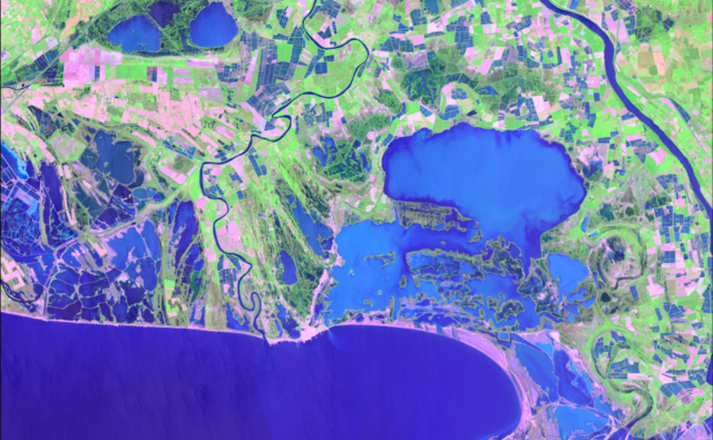
- the inclusion of marine wetlands in the 2023 preliminary mapping,
- developments regarding the use of new data relating to the detection of certain specific types of wetlands,
- the development of functional indicators based on satellite data,
- the production of wetland habitat maps,
- and support for the use of the data produced.
Learn more
Survey of wetland uses following a year of national wetland mapping!
National Wetlands Mapping Symposium (Phase 1)
Project launch – preliminary identification of wetlands in the overseas departments and regions
The Ellenberg approach to identifying probable wetlands in applied research