Tour du Valat
Tour du Valat
  • Navigation access
  • Content access
  • Footer access
  • Adopt a flamingo
  • Documentary portal
  • Search
  • fr
  • en
  • The Tour du Valat
    • History and values
    • The estate
    • Our team
    • Organisation chart and CVs
    • Governance and budget
    • Partners and sponsors
    • Visiting the Tour du Valat
  • Mediterranean wetlands
    • Types of Mediterranean wetlands
    • Threats, issues and protection
    • Spotlight on the Camargue
    • The Mediterranean Alliance for Wetlands
    • The Mediterranean Wetlands Observatory
  • Our actions
  • Media
    • The Library
    • Recent publications
    • Activity reports
    • The HAL portal
    • Books, booklets and reports
    • Institutionnal documents
    • Photo gallery
    • Videos
  • News
  • Support us
    • Adopt a Flamingo
    • Make a contribution
    • Make a donation or bequest
  • Navigation access
  • Content access
  • Footer access
  • Adopt a flamingo
  • Documentary portal
  • Search
  • fr
  • en
Tour du Valat
  • The Tour du Valat
    • History and values
    • The estate
    • Our team
    • Organisation chart and CVs
    • Governance and budget
    • Partners and sponsors
    • Visiting the Tour du Valat
  • Mediterranean wetlands
    • Types of Mediterranean wetlands
    • Threats, issues and protection
    • Spotlight on the Camargue
    • The Mediterranean Alliance for Wetlands
    • The Mediterranean Wetlands Observatory
  • Our actions
  • Media
    • The Library
    • Recent publications
    • Activity reports
    • The HAL portal
    • Books, booklets and reports
    • Institutionnal documents
    • Photo gallery
    • Videos
  • News
  • Support us
    • Adopt a Flamingo
    • Make a contribution
    • Make a donation or bequest
Research institute for the conservation of Mediterranean wetlands
  • Home
  • News
  • Publications
  • New article – Endorheic Waterbodies Delineation From Remote Sensing as a Tool for Immersed Surface Topography
Back to News
  • A- Switch to smaller font size
  • A+ Switch to biggest font size
  • Print
  • Share
  • RSS
Publications Camargue • Published on 21 February 2022

New article – Endorheic Waterbodies Delineation From Remote Sensing as a Tool for Immersed Surface Topography

This paper published in 2021 in the journal “IEEE Geoscience and Remote Sensing Letters” is now available online.

It is the result of a collaborative work between the University of Montpellier, Inria, Inrae, and the Luxembourg Institute of Science and Technology.

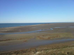
The teams have developed and validated an algorithm to estimate the bathymetry of wetlands or water reservoirs from the knowledge of some topo-bathymetric points measured on the ground or available in existing databases, and the knowledge of water surfaces, estimated by remote sensing, at several dates.

This algorithm can be applied to endoreic wetlands or water reservoirs, whose water surface varies strongly during the year (e.g. shallow wetlands subject to strong evaporation) and thus presents an interesting potential of application for several Mediterranean wetlands.

You can access to it on the Tour du Valat web documentary portal.

Abstract:

For several decades, it becomes possible to delineate waterbodies and their dynamics from optical or radar images, that are now available at high spatial and temporal resolutions. We present here an interpolation approach that takes benefits from this waterbodies delineation in endorheic areas. It consists in computing isovalue contour lines to improve topography estimates classically obtained from measurement points only. The approach, based on a minimization problem, uses thin plate spline (TPS) interpolation functions, the coefficients of which are determined along with the unknown water level of each curve. Results obtained on a generated topography show that this approach, applied with three contour-line curves, yields a lower root mean square error (RMSE) using only one measurement point compared to the one obtained with nine points and the classical approach.

Bibliographical reference:

C. Delenne, J. -S. Bailly, A. Rousseau, R. Hostache and O. Boutron, “Endorheic Waterbodies Delineation From Remote Sensing as a Tool for Immersed Surface Topography,” in IEEE Geoscience and Remote Sensing Letters, vol. 19, pp. 1-5, 2022, Art no. 1502405, doi: 10.1109/LGRS.2021.3079718.


For further

Links

  • Link to the article

Newsletter

Keep up with Tour du Valat news:
Show previous newsletters
News Archives
  • 2025
  • 2024
  • 2023
  • 2022
  • 2021
  • 2020
  • 2019
  • 2018
  • 2017
  • 2016
  • 2015
  • 2014
  • 2013
Agenda Archives
  • 2024
  • 2023
  • 2022
  • 2021
  • 2020
  • 2019
  • 2018
  • 2017
  • 2016
  • 2015
  • 2014
  • 2013
Tour du Valat
Tour du Valat

Le Sambuc - 13200 Arles
France

Phone : +33 (0)4 90 97 20 13

[email protected]


Contact
  • Practical information
    • Calendar
    • Past events
    • Vacancies
    • Interactive map
    • Logo & access map
  • Legal information
    • Legal notice
    • Cookie policy (EU)
  • Linkedin
  • Facebook
  • Vimeo
  • RSS
Gérer le consentement aux cookies
We use cookies to enhance your experience on our web site.
Functional Always active
The technical storage or access is strictly necessary for the legitimate purpose of enabling the use of a specific service explicitly requested by the subscriber or user, or for the sole purpose of carrying out the transmission of a communication over an electronic communications network.
Settings
Le stockage ou l’accès technique est nécessaire dans la finalité d’intérêt légitime de stocker des préférences qui ne sont pas demandées par l’abonné ou l’utilisateur.
Statistics
The technical storage or access that is used exclusively for statistical purposes. Le stockage ou l’accès technique qui est utilisé exclusivement dans des finalités statistiques anonymes. En l’absence d’une assignation à comparaître, d’une conformité volontaire de la part de votre fournisseur d’accès à internet ou d’enregistrements supplémentaires provenant d’une tierce partie, les informations stockées ou extraites à cette seule fin ne peuvent généralement pas être utilisées pour vous identifier.
Marketing
The technical storage or access is required to create user profiles to send advertising, or to track the user on a website or across several websites for similar marketing purposes.
Manage options Manage services Manage {vendor_count} vendors Read more about these purposes
See settings
{title} {title} {title}