Millions of birds illegally killed or captured in the Mediterranean every year: experts sound the alarm
Posted By
marquis
On
In
Media,News,Position papers |
No Comments
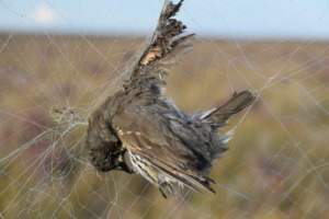
On World Migratory Bird Day, Tour du Valat, EuroNatur and BirdLife International – three leading organisations working to conserve birds and their habitats – are raising the alarm over the scale of illegal killing and trapping of migratory birds across the Mediterranean. The three organisations are urging governments to accelerate implementation of their commitments to reduce these practices by at least half by 2030.
Millions of birds are still killed or captured illegally in the Mediterranean every year. At this rate, states will fail to meet the international commitments set out in the Rome Strategic Plan (2020-2030).
In most of the countries concerned, nature conservation organisations are actively working to combat illegal killing, but lack the resources needed to scale up their efforts.
The solutions already exist. Governments must now implement them at scale, notably through the implementation of National Action Plans.
Born in a woodland in northern Germany and weighing barely a few dozen grams, young European Goldfinches are preparing to embark on a journey of several thousand kilometres to spend the winter in the southern Mediterranean. Their route is fraught with danger: migratory stopover sites are disappearing as a result of urbanisation and wildfires intensified by climate change, leaving them fewer places to rest and exposing them to exhaustion and predators. But it is another danger that will end the journey for many of these birds: trapped for their song and striking plumage, those that survive the trafficking trade are sold illegally, often ending their days in a cage at the window of a flat in Marseille or elsewhere around the Mediterranean basin. But this is far from an isolated case.
“Every year, an estimated 11 to 36 million migratory birds are killed or captured illegally across the Mediterranean.” said Barend Van Gemerden, Head of Global Flyways at BirdLife International.
“That’s why countries in the region have committed to reducing illegal killing and trapping by at least 50% by 2030, under the Rome Strategic Plan of the Convention on the Conservation of Migratory Species and the Bern Convention. Now it’s time to turn that commitment into action.”
NGOs sound the alarm over the lack of progress across the Mediterranean
Progress remains far from sufficient. The Illegal Killing of Birds (IKB-3.0) report, published by BirdLife International and EuroNatur, paints an alarming picture:
“Halfway through the implementation of the Rome Strategic Plan, 83% of the 46 countries assessed have not put in place the measures needed to meet the targets,” said Dr. Justine Vansynghel, Project Manager Migratory Birds at EuroNatur. “This gap is deeply concerning, and it shows just how much work remains to be done if governments are serious about honouring their commitments.”
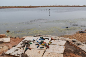
Meanwhile, after four years of monitoring across eight countries in the Mediterranean basin, the Mediterranean Waterbirds Network (MWN), confirms the persistence and diversity of threats facing migratory birds, including unregulated shooting, trapping and lead pollution.
MWN monitoring reveals a mixed picture across different territories. To be effective, responses must reflect the specific realities and challenges of each country.
“This is the first time we have produced harmonised data on this issue,” says Laura Dami, Coordinator of the Mediterranean Waterbirds Network. “At Mediterranean scale, these data highlight how much remains to be done, but they allow local organisations to develop country-specific recommendations to comply with their international commitments.”
There is reason for hope: in most of the countries concerned, partners of BirdLife, EuroNatur and MWN are already actively working to combat illegal killing and trapping. MWN organisations are developing recommendations for each of the eight countries involved in the monitoring programme.Three key levers for action stand out: closing legal loopholes; securing sustainable funding to strengthen scientific monitoring and public awareness; and improving cooperation between public authorities, hunters and conservation organisations. These measures are essential to turn international commitments into tangible results on the ground.
Our organisations call on governments to accelerate the fight against IKB, in accordance with their countries’ international obligations by working with all relevant stakeholders to advance the development, funding, and implementation of national action plans. Migratory birds cross multiple countries throughout their life cycle, making coordinated action essential. Progress in one country will only be effective if similar measures are implemented across the entire flyway.
About MWN
Founded in 2012, the Mediterranean Waterbirds Network (MWN) brings together a range of partners (local and international NGOs, universities, government bodies, etc.) involved in the monitoring and protection of waterbirds and wetlands in the Mediterranean region, with the aim of strengthening waterbird monitoring and wetland conservation. It initially developed in collaboration with five North African countries (Morocco, Algeria, Tunisia, Libya and Egypt), in partnership with the Tour du Valat and the French Office for Biodiversity (OFB), aiming to improve both the quantity and quality of this monitoring. Since 2017, the Mediterranean Waterbird Network (MWN) has expanded to include other Mediterranean countries to foster scientific and technical exchanges and collaboration. Among these countries, key collaborations include those with: Albania, Spain, France, Italy, Greece, Serbia, North Macedonia, Montenegro, Portugal and Turkiye.
Tour du Valat is a research institute dedicated to the conservation of Mediterranean wetlands, based in the Camargue (France), and operating as a private foundation recognised as public utility. Founded in 1954 by Luc Hoffmann, Tour du Valat has since developed its research activities with one constant aim: to better understand these environments – wetlands are the planet’s most productive and most threatened ecosystem – in order to better manage them. Convinced that Mediterranean wetlands can only be preserved if human activities and the protection of our natural heritage work hand in hand, Tour du Valat has, for many years, been developing research and integrated management programmes that foster dialogue between stakeholders and scientists, mobilise a community of stakeholders and promote the benefits of wetlands to policy makers.
EuroNatur is a nature conservation foundation based in Radolfzell, Germany. EuroNatur’s efforts for a Europe with free-flowing rivers, ancient forests and a rich variety of cultural landscapes are transboundary in nature; they strengthen local conservation organizations and create international networks between them. Together with their Europe-wide partner network EuroNatur creates solutions that allow humans to live and work in harmony with nature. The protection of Europe’s migratory birds and the fight against the illegal killing of birds is one of the issues that EuroNatur has been addressing since the foundation was established.
At the Tour du Valat, the sixth edition of the ‘Biodiversity and Vectors’ summer school spent five days exploring the links between pollution and vectors of infectious agents affecting human, animal and plant health.
Organised as part of the Key Challenge ‘Infectious Risks and Vectors in Occitanie[4]’ (RIVOC), the 6th edition of the ‘Biodiversity and Vectors’ summer school took place from 14 to 18 September 2026 at the Tour du Valat.
This training course, open to both students and professionals, aimed to explore vector-borne diseases affecting humans, animals and plants through a ‘One Health’ approach, using various models involving mosquitoes, ticks, molluscs, aphids and many more, and considering prevention and control strategies.
This year’s programme focused on the theme of pollution and its impacts on vectors and the diseases they transmit, in association with the BiodivOc Key Challenge. Various sessions addressed topics such as chemical pollution and light pollution, as well as the impact of vector-borne disease management itself on environmental pollution.
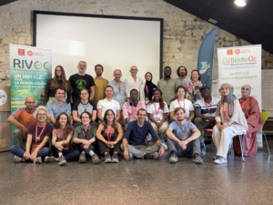
This sixth edition brought together 17 people from France, Morocco and Côte d’Ivoire, mainly students but also two professionals, working in the fields of human, animal or plant health.
Spanning over a month, from 18 August to 25 September, the harvest took place as the grapes ripened, keeping the farm team busy throughout August and September.
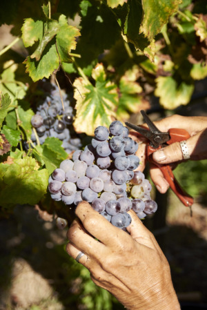
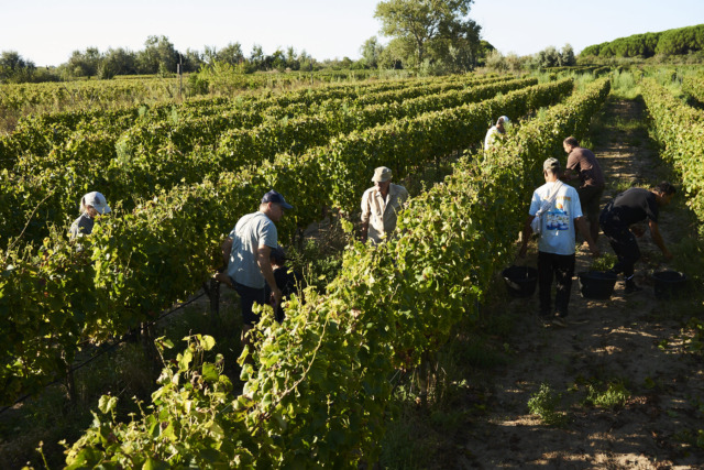
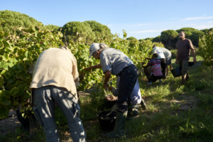
The season began on 18 August with the harvest of the Merlot grapes intended for our 100 per cent organic grape juice. From 7.00 am, around twenty employees, former employees, volunteers from the Tour du Valat and seasonal workers lent a hand to the farm team. Together, they harvested 7,634 kg of grapes during this collective morning’s work, which went on to produce 4,938 litres of grape juice, now available for sale.[6]
The harvest then continued across the various plots at the Mas du Petit Saint-Jean. In total, 11 further mornings of harvesting involved 47 different people.
At Mas du Petit Saint-Jean, the grapes are harvested by hand, a method adapted to the scale of production and the way the farm operates. This manual harvest requires time and care, particularly when sorting the bunches, but it is also a special time in the life of the Mas. For a few weeks, staff, former staff, seasonal workers and volunteers come together with a shared goal.
Once picked, the grapes are taken directly to the Mas du Petit Saint-Jean’s winery, where they are destemmed, then pressed and placed in vats. Over the coming months, they will be transformed into the agroecological farm’s new vintages, produced from organically grown grapes.
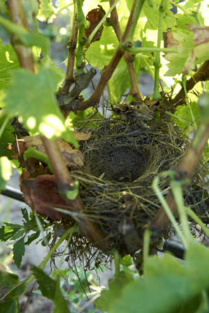
During the grape harvest, we also discovered around fifteen passerine nests built right amongst the vines and hidden by the foliage. Most of them were nests of goldfinches and corn buntings.
This discovery serves as a reminder that vineyards are also habitats for wildlife, particularly for birds that find refuge there to nest.
🍷Until the new 2026 vintages are ready, wines from previous vintages at Mas du Petit Saint-Jean are still available for sale. Do feel free to discover them and taste the produce from this agroecological farm.
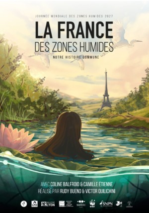
We are delighted to introduce a new initiative from Flamingo[7], a crowdfunding platform dedicated to wetlands: La France des zones humides (France’s Wetlands), a short film directed by Rudy Bueno and narrated by Camille Etienne that explores the history and importance of wetlands!
What if we told you that Paris, Lyon and Nantes were once vast wetlands?
It is hard to imagine… yet our cities were built on these landscapes. Over the past century, two thirds of France’s wetlands have disappeared. And these ecosystems are vital allies: they support extraordinary biodiversity, store carbon and hold back floodwaters.
🎬 La France des zones humides traces this story, aiming to reach far beyond those already aware of what’s at stake. Planned for World Wetlands Day 2027, ahead of the French presidential election, the film hopes to inspire change.
Together with an incredible team, including Camille Etienne, Coline Balfroid and many others, we’ll travel across France to discover how wetlands have shaped our landscapes and why their future matters to us all.
This crowdfunding campaign is crucial: it will help fund the film’s post-production and its distribution throughout France. We’ve already secured 70% of the funding. We need your help to raise the remaining 30% ❤️
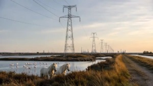
The Tour du Valat continues his campaign against the proposed extra-high-voltage overhead power line between Fos-sur-Mer and Jonquières-Saint-Vincent.
As part of the consultation process on the harmonisation of town planning documents, the Tour du Valat has submitted a response expressing its opposition to the proposed amendments. These could have significant consequences for soil, water, agriculture and biodiversity in an area already under considerable pressure.
Our analysis is based in particular on four key findings:
Protected areas must not be used as a variable for adjusting to reindustrialisation. The removal of 7.5 km of ecological corridors from the Arles Local Urban Development Plan (PLU) would contribute to the fragmentation of natural areas of international importance.
Cumulative impacts must be fully considered. Land-use change, biodiversity, water and landscapes: the decarbonisation of industry cannot be credible if it results in the degradation of ecosystems.
Water is a major limiting factor in reindustrialisation. Until the water feasibility of the projects has been demonstrated, the projected energy requirements remain uncertain and the line could be planned for projects whose implementation is not guaranteed.
There will be no local acceptance without true co-construction. Reopening the review of alternatives and taking the CNDP’s recommendations into account are essential to enable an informed decision.
For the Tour du Valat, the energy transition and the decarbonisation of industry must go together with the ecological transition, fully integrating the challenges of energy, land and water efficiency, as well as the ‘One Health’ approach.
The public inquiry is scheduled for the autumn. Campaigning continues, notably with an event organised on 19 September by the Stop THT collective. The Tour du Valat will continue to monitor the case and put forward its arguments during the next stages of the procedure.
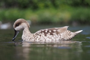
A study published last July in the journal Animal Conservation provides the very first national-scale estimate of the breeding population size of the Marbled Teal (Marmaronetta angustirostris) in Morocco, also known as the Marbled duck.
Conducted by a team bringing together Tour du Valat, École Pratique des Hautes Études, GREPOM/BirdLife Morocco, the Faculty of Sciences Ben M’sik in Casablanca and BioSphère Environnement, this research fills a gap that had previously made it difficult to reliably assess the species’ status in the country and, consequently, to effectively plan its conservation.
A threatened nomadic species
The Marbled Teal is classified as globally threatened and vulnerable in Europe by the IUCN. Unlike most waterfowl, it does not follow a typical migratory pattern: its often erratic movements follow water availability in temporary wetlands, making it particularly difficult to monitor and count.
Launched in 2023, this national monitoring programme is based on a two-stage random sampling design: 35 primary units of 100 km², within which 187 secondary sampling units of 0.25 km² are nested, covering the entire Moroccan territory from the mouth of the Moulouya River in the north to the Saharan wadis in the south. The objective was to estimate the size of the Marbled Teal breeding population and identify key breeding habitat features.
A national Marbled Teal population estimated at 386 broods
At the scale of the sampled sites, covering 46.75 km² of wetlands, the best model estimated a total of 24 broods, with an average detection probability of 0.71, highlighting the need to account for imperfect detection in field surveys. Extrapolated to all Moroccan wetlands (748 km²), this estimate corresponds to a national breeding population of 386 broods. The field data were analysed using models designed to correct for biases associated with the species’ imperfect detectability. These results provide the first robust national-scale estimate of Marbled duck breeding population size in Morocco.
Emergent vegetation and wetland type, particularly ponds, emerged as the main predictors of brood abundance at a site — a valuable lead for guiding future habitat-focused conservation actions.
A new monitoring protocol adaptable to other contexts
Beyond this reference figure, the authors propose a monitoring and modelling protocol that can be applied to other species and other regions, helping to sustainably improve the monitoring and conservation of threatened waterbird species in North Africa.
Publication reference
📄 Bouchri, H., El Hamoumi, R., Musseau, R., Béchet, A. & Champagnon, J. (2026). Using Two-Stage Random Sampling and N-Mixture Models to Estimate the Breeding Population Size of a Threatened Nomadic Species in Morocco. Animal Conservation. https://doi.org/10.1111/acv.70087[10]
Restoring European coastal wetlands: climate benefits vary from one context to another
A new study published in Ecological Engineering sheds light on the effects of coastal wetland restoration on the climate, particularly on carbon dioxide (CO₂) and methane (CH₄) fluxes — two greenhouse gases whose exchanges with the atmosphere play an important role in regulating the Earth’s climate.
Conducted as part of the EuropeanRESTORE4Cs[11] project, in which Tour du Valat is a partner, the study brought together around fifty researchers across six pilot wetlands covering a wide range of European ecological contexts: Ria de Aveiro (Portugal), the Eastern Scheldt Estuary (Netherlands), the Camargue (France), the Marjal dels Moros (Spain), the Danube Delta (Romania) and the Curonian Lagoon (Lithuania).
Over four seasons, the teams simultaneously measured CO₂ and CH₄ fluxes at preserved, degraded and restored sites using static chambers. The goal was to determine the extent to which restoration measures, encouraged by European policies, translate into a measurable climate benefit in terms of CO₂ equivalents (CO₂-eq).
Results vary depending on the type of gas and wetland
CO₂ fluxes depend primarily on vegetation cover and the flooding regime at the landscape scale, whilst CH₄ emissions respond more sensitively to factors such as water quality, salinity, and hydrological dynamics.
Among the measures studied, the restoration of seagrass meadows through replanting shows the clearest positive climate signal, with a significant reduction in the CO₂-eq. balance, whether the effect of methane is considered over the short term (20 years) or the longer term (100 years). Reducing lagoon eutrophication through improved water treatment also showed a positive effect, but only in the short term (over a 20-year horizon). In contrast, other restoration measuresmodified CO2 and CH4 fluxes in opposing directions, with no significant effect on the overall balance.
Restoration strategies need to be adapted to each context
This work provides useful insight for wetland managers: the climate benefits of restoration are neither automatic nor uniform. They depend on the greenhouse gas in question, the type of wetland, and the specific restoration measure undertaken. This makes a case for restoration strategies tailored to each context, and for rigorous monitoring of several greenhouse gases — particularly CO₂ and CH₄ — to accurately detect and quantify potential climate benefits.
These results form part of the work carried out by the European RESTORE4Cs project, which develops knowledge, data, and decision-support tools to support the conservation and restoration of European coastal wetlands. They contribute, in particular, to theEuropean Coastal Wetlands Interactive Platform[12] and itsDecision-Support Toolbox[13], which enable users to explore the project’s results and support the prioritisation of restoration actions.
The parliamentary process for the Emergency Agricultural Bill has now been completed. Although the proposal to redefine wetlands was ultimately not dropped, the adopted text nevertheless introduces a concerning change: the possibility of taking the functionality of wetlands into account when implementing compensation measures.
This provision was not struck down by the Constitutional Council. For the on-the-ground stakeholders, it represents a major environmental setback, weakening the very principle of wetland protection.
This development comes in a particularly paradoxical context: as of 10 August, 92 departments were subject to water-use restrictions, 67 of them at crisis level. Weakening the protections afforded to wetlands at a time when France is facing growing pressure on its water resources amounts to jeopardising ecosystems that are precisely essential allies in strengthening the resilience of territories.
In response to this situation, Tour du Valat has mobilised alongside other on-the-ground stakeholders. A letter of thanks was sent to the members of Parliament who helped prevent the redefinition of wetlands, and six institutional meetings with parliamentarians provided an opportunity to directly raise the issues surrounding their protection and sustainable water management.
On 10 July 1976, France unanimously adopted a landmark law for nature protection. Fifty years later, this legacy is under threat, at a time when biodiversity loss and climate change are intensifying.
To mark this anniversary, Tour du Valat has joined forces with several nature conservation organisations to remind us that protecting the living world is neither a luxury nor a barrier to development: it is a prerequisite for our collective resilience.
The 1976 Act laid the foundations for many French biodiversity protection policies: species protection, nature reserves, impact assessments, and the recognition of nature as a common heritage. Fifty years on, it is essential to preserve this legacy and carry forward its ambition, rather than gradually weakening the protections built up over recent decades.
The joint press release highlights, in particular, the contradictions between stated biodiversity ambitions and certain recent legislative developments, particularly concerning wetlands, water, and protected areas.
Most land-dwelling birds are diurnal species. However, the majority of them migrate at night. In order to quantify this phenomenon more accurately and gain a better understanding of its evolution, an international study, published in the journal Current Biology, combined and analysed data from more than 400 small birds fitted with tiny tracking devices.
Why do diurnal species suddenly change their behaviour when it comes to migrating? Although widely documented, this fascinating phenomenon still raises many questions today. Flying at night may allow birds to benefit from more stable atmospheric conditions, avoid the heat and diurnal predators, or even guide themselves by the stars. However, measuring the true extent of this behaviour across dozens of species has, until now, remained difficult, as radar, acoustic recordings and bird ringing provide information on the passage of birds, but rarely on the complete journey of a single individual or the exact duration of its flights.
Tiny geolocation trackers to monitor flights
An international team of more than seventy researchers has compiled published and unpublished data from multi-sensor trackers fitted to 411 individual birds belonging to 56 species of passerines and other terrestrial birds. A database of this kind, combining so many species and individuals fitted with trackers over the long term, is a first in the field, particularly for small birds.
Attached to the bird’s back, these sensors record light, acceleration and atmospheric pressure at regular intervals, enabling data to be collected throughout the bird’s entire migratory journey. Their weight never exceeds 5 per cent of the bird’s body weight, so as not to affect its activity.
Nocturnal migration: a highly prevalent strategy
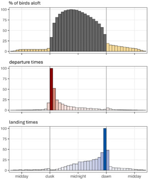
Breakdown of migratory flight times between day and night, for all flights combined (12,542 flights) undertaken by 411 individuals, totalling 84,477 hours of flight time
Analysis of this extensive dataset confirms and refines what several smaller-scale studies had already suggested:
The vast majority of migratory flights take place at night: across all the species studied, 82 per cent of all recorded flights occurred during the night. When crossing ecological barriers such as deserts or the sea, some flights may continue during the day.
Nocturnal migration is the dominant strategy for many species: in 41 of the 56 species studied, more than 90 per cent of migratory journeys took place at night.
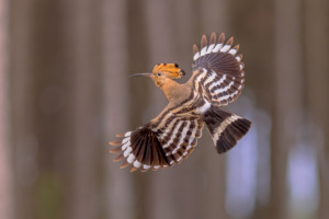
Some species believed to migrate both by day and by night actually migrate almost exclusively at night: for example, the Eurasian Hoopoe (Upupa epops) undertakes 91 per cent of its migratory flights at night, which contradicts previous observations and highlights that diurnal activity does not necessarily reflect the timing of the migratory flight.
Nocturnal migratory birds tend to optimise their flight time during the night: departures and arrivals are closely aligned with dusk and dawn, with 92 per cent of species taking off at dusk and 96 per cent landing at dawn.
A behaviour passed down through evolution
Beyond these findings, the researchers sought to understand the origin of this behaviour. By placing the 56 species within their phylogenetic tree, they demonstrate that closely related species bear a strong resemblance to one another: nocturnal migration is passed down and maintained within lineages, rather than depending on the specific ecological conditions of each species. The authors remain cautious, however: this trait could also have arisen independently on several occasions, under similar pressures.
This pattern is not, however, universal. The European bee-eater is the clearest counter-example: it flies almost exclusively by day, its gliding flight dependent on thermal updrafts. Certain groups, such as pipits and wagtails, undertake a higher proportion of daytime flights than others, often over short distances, early in the morning.
Gaining a better understanding of birds’ migratory strategies is not merely an academic matter: populations of nocturnal migratory birds are particularly vulnerable to light pollution and collisions with human infrastructure (buildings, wind turbines, power lines), which are becoming increasingly common along their flight paths. Developing detailed maps of the extent and timing of nocturnal migration, species by species, is an essential step towards identifying the periods and areas where these risks are highest, and tailoring conservation measures accordingly.
Publication reference
Dufour P., Nussbaumer R., Doniol-Valcroze P., Rime Y., Adamík P., Åkesson S. et al., Briedis M. 2026. Multi-sensor tracking reveals the extent of nocturnal migration in landbirds. Current Biology 36(14):3697-3706.e3. DOI: 10.1016/j.cub.2026.06.030[17]
Natur’Adapt Sud: the project’s final documents are now available online
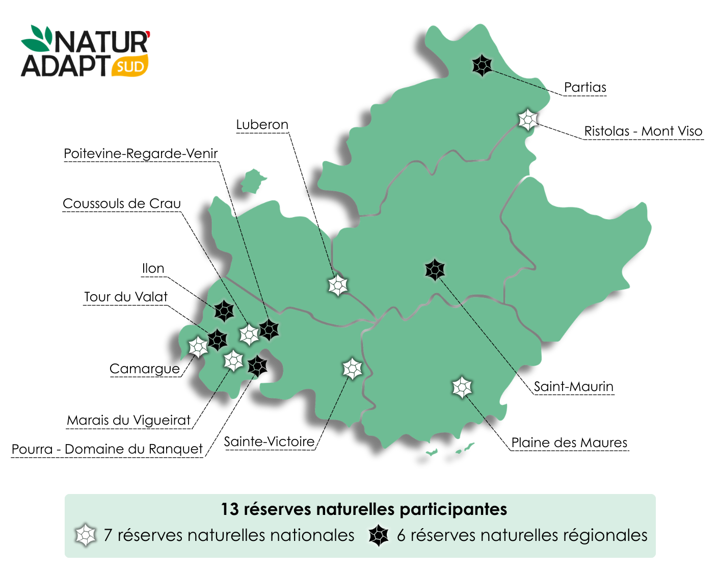
The vulnerability assessments and climate change adaptation plans carried out by the 13 nature reserves involved in the Natur’Adapt Sud 2024–2026 project are now available on the Tour du Valat website.[18]
The Natur’Adapt approach
Developed as part of the LIFE Natur’Adapt project (2018–2023), the Natur’Adapt initiative works to collectively anticipate developments linked to climate change and adapt the way natural areas are managed in response to its consequences. Today, the Natur’Adapt initiative is driven by a community of people concerned and aware of the challenges posed by climate change and nature conservation, on the collaborative platform of the same name.[19]
Launched in 2024 by the Tour du Valat, the Natur’Adapt Sud project[20] was a direct continuation of this work: using the tools and methods developed during the LIFE project, it provided support to the managers of 13 sites and 11 organisations in their efforts to adapt to climate change.
How can we adapt to climate change?
Current climate change is characterised by its intensity, its rapid pace and its human-induced nature.
Although the climate has always been subject to change, the warming observed since 1900 is primarily caused by human activity. It is linked in particular to changes in land use (deforestation, urbanisation, etc.) and to the high levels of greenhouse gas (GHG) emissions produced by human activities. Unfortunately, even if we reduce GHG emissions today, the effects of global warming will continue for decades, or even centuries. However, other measures implemented now can limit the extent of future warming: this is known as climate mitigation.
Adaptation measures, such as those proposed in the adaptation plans drawn up by nature reserves, can also be implemented: these are necessary to prepare for the inevitable effects of global warming that are already underway. Thus, the objectives, strategies and actions set out in the adaptation plans are proposals intended to guide the drafting of the management plan, so that it incorporates climate change and management is designed with a more dynamic view of ecosystems in mind. The proposed adaptation measures may be discussed, amended, clarified and prioritised during future consultations organised with governing bodies, local stakeholders and partners.
The Natur’Adapt Sud 2024–2026 project has made it possible to:
Build the capacity of nature reserve managers in the South Region on the topics of climate change and its impacts on nature;
Carry out, for each participating site, an assessment of vulnerability and opportunities in the face of climate change, and draw up a management adaptation plan, which can then be incorporated into the management document.
These documents are now available on the Tour du Valat website.[21] In line with the Natur’Adapt philosophy, we hope they will inspire other managers to take climate change into account in the management of protected natural areas.
New public session of the MOOC on identifying and counting waterbirds in North Africa and the Sahel
Following a successful first session, the RESSOURCE project is launching a second session of its free online training course dedicated to waterbirds of North Africa and the Sahel. Available in French on the IUCN-PAPACO (Programme on African Protected Areas and Conservation) MOOC-Conservation platform, this course offers an advanced introduction to the identification of waterbirds in the area and to census techniques.
The MOOC-RESSOURCE offers six modules (about 40 hours of training) with exceptional educational content: more than 5,000 photographs of birds, 219 species identification sheets, 40 educational videos and 23 video interviews with experts. The course explains why wetlands and waterbirds are of interest; it gives a voice to those working to protect them across the northern half of Africa; it teaches participants how to identify no fewer than 210 species; it introduces various techniques for counting bird populations; and it explores how to analyse, promote and benefit from the results of this work.
The aim is to create a network of qualified observers for wetland conservation.
A MOOC recommended by the participants!
Over 97% of those who attended the course recommend following this MOOC! Of the 1,600 enrolled, 172 obtained their certificate. The others can re-enroll this year if they wish.
Reviews from our students:
“I found this course very useful. The skills I learnt on the MOOC and was able to put into practice […] include understanding how to identify birds based on their morphology and behaviour, as well as being able to count them. Nature is simply extraordinary, and ornithology proved it to me!”
Fatou Cissé Thialaw, a student on the Ornithology module of the OCD Master’s programme, who has completed the MOOC ‘Identifying and Counting Waterbirds of North Africa and the Sahel’
« Pour l’identification des familles, des oiseaux : le MOOC m’a permis d’élargir mes connaissances dans ce domaine. J’encourage les écogardes du Doudj, les agents des parcs nationaux, mais aussi les étudiants à suivre ce MOOC. »
Mohamedine Seck, eco-guard at the Doudj National Bird Park
The wetlands of North Africa and the Sahel are home to millions of waterbirds, both migratory and resident. These species play a vital role in local ecosystems and contribute directly to the food and financial security of many communities in the area. As pressure on these fragile environments increases, the development of networks of trained observers is becoming a priority for their conservation.
Useful information
This second session will run from 15 September 2026 to 31 May 2027. In addition to the educational content, it includes access to forum areas where participants can interact with the training team and follow the course at their own pace.
This year, to improve accessibility, the content will be available for download so that it can also be accessed offline.
Developed by the RESSOURCE project in collaboration with the Tour du Valat and the French Office for Biodiversity, this project is supported by the FFEM and the European Union.