
Objectives
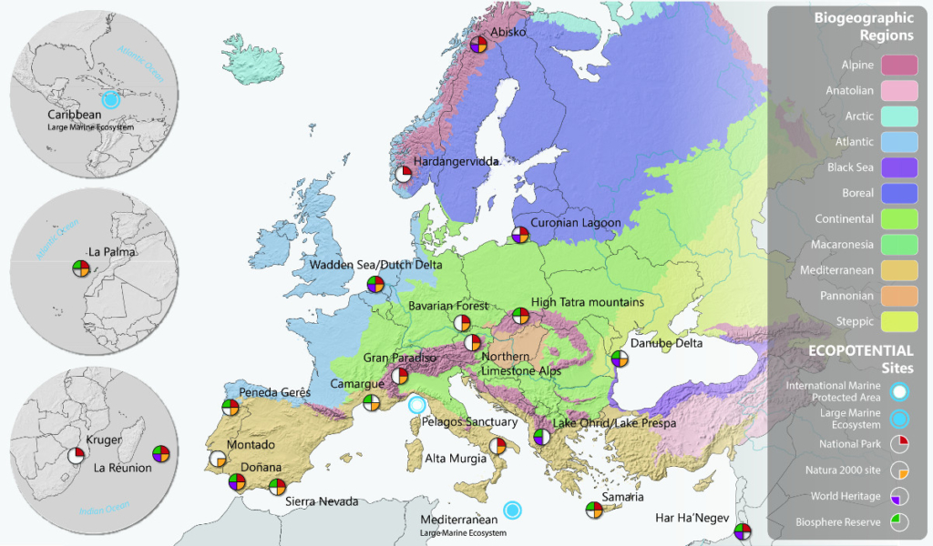
Bringing together a consortium of 40 research institutes, the aim of the European Ecopotential project is to monitor and model the status and trends of ecosystems and the services they provide by focusing on twenty pilot sites, including the Camargue Biosphere Reserve (project website [1]).
 [2]
[2]The methodology employed is based on the utilisation/acquisition of field and satellite data, which are exploited using innovative geostatistical and macro-system ecology approaches.
The project has two goals:
- To develop remote sensing tools for monitoring trends in Camargue wetlands,
- To preserve the functions and services provided by Camargue wetlands.
Context
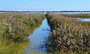
The Camargue Biosphere Reserve in the Rhone Delta covers 1930 km2 in the south of France, 480 km2 of which are in the Mediterranean Sea. There are several emblematic wetlands including salt meadows, reed beds, lagoons, freshwater marshes, wet meadows, semi-permanent brackish marshes, and temporary ponds. These habitats are interspersed with agrosystems dominated by rice farming and salt production.
About 730 million m3 of freshwater are pumped from the Rhone into the delta every year through a complex network of irrigation and drainage canals to compensate for the diking of the river and prevent the salinization of the soil.
This freshwater is mainly used for rice farming, but it also contributes to maintaining or increasing the ecosystem services provided by wetlands such as ecotourism, biodiversity conservation, waterfowl hunting, professional and recreational fishing, as well as the harvesting of reeds and the grazing of Camargue bulls and horses. In the southern part of the delta, 100 million m3 of sea water are pumped into the lagoons to produce salt.
The fragile balance between the terrestrial, freshwater and saltwater ecosystems is threatened by climate changes, which will modify precipitation, evapotranspiration, the flow of the Rhone, and the sea level. World commodity market forces may also alter those in charge of exploiting natural resources, particularly the allocation of water.
Our challenge will be to maintain the biodiversity of Camargue wetlands and the services they provide, while preserving Mediterranean flora and fauna.
 [3]
[3]Expected results
The Ecopotential project combines remote sensing and modelling to monitor and better understand the short- and long-term changes likely to affect Camargue wetland ecosystems and the services they provide to people.
Its goal is to facilitate the work of protected area managers, by providing them with ready to use tools that can link their on-site observations with remote sensing data.
The tools for mapping the total area covered by water on a monthly basis or the agricultural matrix (types of crops) on an annual basis, will thus be developed by using recent European Sentinel images and other satellite images. Climate estimates for 2050 and 2100 will be analysed to determine their impact on the hydrology of Camargue marshes and the whole Mediterranean Basin.
This information will be shared and used to promote management practices and ways to adapt among the different stakeholders concerned, and to identify the areas that are suitable for the restoration or creation of wetlands in the upcoming decades.
 [4]
[4]Team
Project leaders: Brigitte Poulin [5] and Ilse Geijzendorffer
Themes: Management and restoration of Natural and Agricultural ecosystems & Science and Society Interfaces
Staff involved: Samuel Hilaire [6], Gaëtan Lefebvre [7], Clément Merle, Lauren Redmond, and Loïc Willm [8].
Date of project: 2015-2019
Partners
Technical partners
- Parc naturel régional de Camargue [9]
- Syndicat Mixte pour la Gestion et la Protection de la Camargue Gardoise [10]
- GEO BON [11] (Global Earth Observation Biodiversity Observation Network)
Financial partner
![]()
This project has received funding from the European Union’s Horizon 2020 research and innovation programme under grant agreement No 641762.
Publication(s)
Geijzendorffer IR, van Teeffelen AJ, Allison H, Braun D, Horgan K, Iturrate-Garcia M, Santos MJ, Pellissier L, Prieur-Richard AH, Quatrini S, Sakai S. How can global conventions for biodiversity and ecosystem services guide local conservation actions?. Current Opinion in Environmental Sustainability. 2017 Dec 31;29:145-50.
Hummel C., Provenzale A., van der Meer J., Wijnhoven S., Nolte A., Poursanidis D., Janss G., Jurek M., Andresen M., Poulin B., Kobler J., Beierkuhnlein C., Honrado J., Razinkovas A., Stritih A., Bargmann T., Ziemba A., Bonet-García F., Adamescu M.C., Janssen G., Hummel H. 2017. Ecosystem services in European protected areas: Ambiguity in the views of scientists and managers? PLoS One. 2017 Nov 15;12(11):e0187143. doi: 10.1371/journal.pone.0187143. eCollection 2017.
Navarro LM, Fernández N, Guerra C, Guralnick R, Kissling WD, Londoño MC, Muller-Karger F, Turak E, Balvanera P, Costello MJ, Delavaud A. et al. Monitoring biodiversity change through effective global coordination. Current Opinion in Environmental Sustainability. 2017 Dec 31;29:158-69.
Perennou C., Guelmami A., Paganini M. Philipson P., Poulin B., Strauch A., Tottrup C., Truckenbrodt J., Geijzendorffer I.R. in press. Mapping Mediterranean wetlands with remote sensing: a good –looking map is not always a good map. In Elsevier Series: Advances in Ecological Research. Volume 58. Ecological Biomonitoring (Bohan D, Dumbrell A, Woodward G, Jackson M, eds).