
Europe’s coastal wetlands account for less than 10 per cent of the region’s wetlands, yet they play a disproportionately important role in mitigating climate change and adapting to its effects, whilst also hosting some of the continent’s richest biodiversity. To restore them effectively, we need to know where to prioritise action and which issues to take into account.
A new study, carried out as part of the Horizon Europe RESTORE4Cs project [1], offers a unique spatialised dataset that links three dimensions: habitats, ecosystem services provided to communities, and human activities, including the pressures these exert on ecosystems.
Six pilot sites representing Europe’s coastal regions
This work draws on insight from six coastal wetlands in Europe, spread across the Atlantic, Mediterranean, Baltic and Black Sea coasts: the Ria de Aveiro (Portugal), Marjal del Moro north of Valencia (Spain), the Camargue (France), the Eastern Scheldt estuary (Netherlands), the Curonian Lagoon (Lithuania) and the Danube Delta (Romania).
The Tour du Valat is participating in the project as the leader of Work Package 7, as well as being responsible for activities at the Camargue pilot site. It also contributes its scientific expertise on Mediterranean wetlands, alongside the University of Aveiro, which is coordinating the project, and all the European partners from the R4Cs project.
A database built on the basis of field expertise
The database was compiled using the expertise of the teams at each pilot site: these teams first mapped the landscape units, then linked them to ecosystem services, as well as the activities and pressures affecting them.
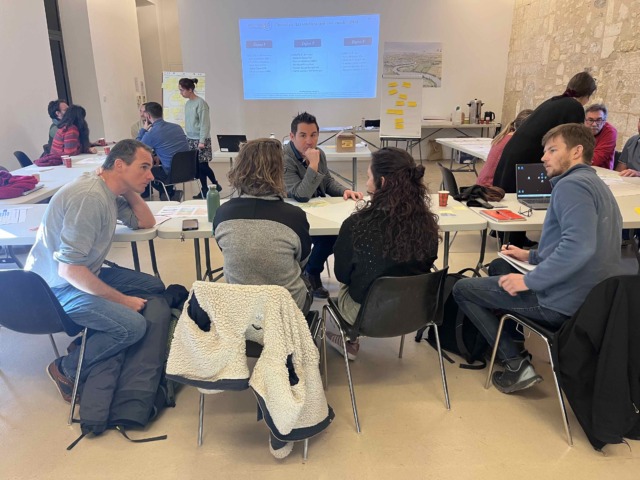
At each site, a participatory workshop brought together local stakeholders (public authorities, local governments, NGOs, fishermen, users, etc.) to prioritise the importance of various restoration criteria – thereby involving local stakeholders in the decision-making process, rather than treating them only as sources of information.
In total, the data collected comprises around 100 habitat records, more than 20,000 activity-pressure combinations and more than 1,600 ecosystem service records.
This data feeds into a ‘Toolbox’ for spatial prioritization : a decision-support tool that enables managers and decision-makers to identify where restoration can maximise co-benefits (climate, biodiversity, water quality). Comparable data has also been produced at European scale, using a different methodology adapted to that level; it is accessible via the R4Cs mapping platform.
These resources aim to make trade-offs between wetland uses explicit, and to support implementation of the EU Nature Restoration Regulation and the Biodiversity Strategy to 2030.
Focus on the Camargue pilot site
 Applying this methodology on the Camargue pilot site, three restoration scenarios for 2050 emerged from a participatory process organised by the Tour du Valat, MedWet and Vertigo Lab, bringing together local stakeholders last November:
The process involved 19 interviews to clarify the context and collect data, followed by a workshop attended by 14 local stakeholders, who were invited to propose indicators for each criterion based on their expertise. These criteria covered socio-economic aspects (agriculture, livestock farming, hunting, tourism, nature conservation, etc.) as well as environmental aspects (habitats, biodiversity, climate, water, etc.) and socio-cultural aspects (heritage, health, research, participation). In terms of the preferences expressed, activities in the primary sector came top (11% of the weighting, driven mainly by agriculture and livestock farming), followed equally (10%) by activities in the tertiary sector (tourism and conservation), risk management costs (protection against flooding and submersion) and biodiversity. At the level of broad themes, however, it is the environmental dimension that emerges as the priority. The multi-criteria analysis shows that the adaptive management scenario with nature-based solutions is the preferred option (confirmed by three normalisation methods). It offers the best balance between socio-economic, environmental and socio-cultural issues, whilst remaining the most acceptable locally. It should be noted that the ‘naturally evolving landscape’ scenario would enable a significantly greater reduction in the region’s greenhouse gas emissions, but at the expense of socio-economic activities. |
Publication reference:
Oliveira B.R.F., Camacho A., Guelmami A., Schroder C., Bègue N., Bučas M., Cazacu C., Ciravegna E., Coelho J.P., Constantin R.G., Hilaire S., Kataržytė M., Morant D., Picazo A., Polman N., van Puijenbroek M., Raoult J., Rochera C., Ronse M., Sella L., Sousa A.I., Racoviceanu T., Rota F.S., Vaičiūtė D., Lillebø A.I. 2026. European coastal wetlands datasets and their use in decision-support tools for policy restoration objectives. Environmental Science & Policy 179:104386. doi: 10.1016/j.envsci.2026.104386 [2]
Contact:
Anis GUELMANI [3] | Project Leader, MWO coordinator