The Tour du Valat has published the first map of the peatlands in the Rhône delta. Covering surface area, maximum depth, amount of carbon stored and state of degradation, this leaflet, available online and from project partners, is a first step towards improving our knowledge on these little-known yet essential ecosystems.
Peatlands: unexpected allies in the fight against climate change
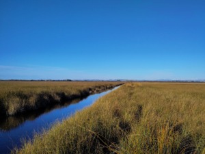
Peatlands are wetlands characterised by soil that is very rich in organic matter. These environments are one of the world’s main carbon sinks, but they are now threatened by human activity: their degradation causes greenhouse gas emissions estimated at nearly 5% of global emissions.
In France, there is a severe lack of data on these ecosystems: to date, neither their greenhouse gas emissions nor the amount of carbon they store are included in the national carbon footprint.
| Did you know?
The peatlands of the Rhône delta cover at least 2,000 hectares (equivalent to 2,800 football pitches) and are thought to store 3.2 million tons of carbon, which is equivalent to the carbon stored in 40,000 hectares of temperate forest. |
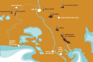
A unique inventory in the Rhône delta
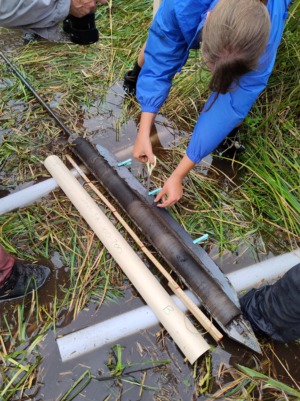
In 2024 and 2025, the Tour du Valat led a project to localize and characterize the peatlands of the Rhône delta. For the main sites, the project teams quantified carbon stocks, assessed the conservation status of the peatlands and traced their evolution over time.
The map below summarizes this data in an accessible format so that it can be shared with nature reserve managers and the general public. You can download it free of charge or obtain a paper copy from our local partners, such as Marais du Vigueirat or Camargue Regional Nature Park. It is a valuable resource for gaining a better understanding of our region and preserving its exceptional natural heritage.
