
The French Office for Biodiversity (OFB), the Tour du Valat, a research institute for the conservation of Mediterranean wetlands, and their partners have today published an original modelling of their count data for migratory birds and large mammals in Chad. This modelling makes it possible to offer local decision-makers several zoning options for a potential new protected area that maximise biodiversity benefits and minimise the social impact.
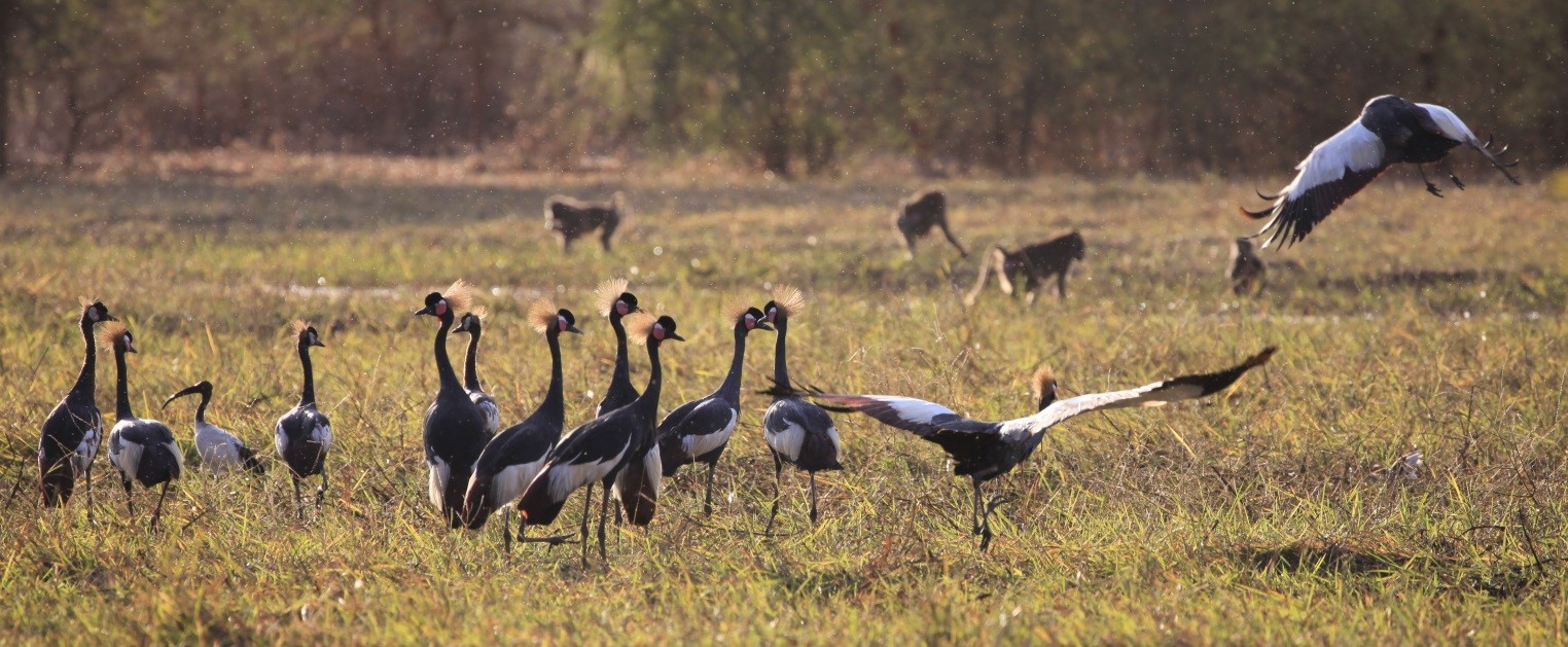
Crowned cranes Balearica pavonina in the Bahr Aouk and Salamat floodplains Ramsar site in Chad – Zakouma National Park. This species is now considered globally threatened by the IUCN © Mondain-Monval – Defos du Rau – OFB.
Human pressure on ecosystems has increased dramatically in recent decades, affecting even the most remote regions on every continent. To mitigate its effects, it is essential to designate protected areas in regions that still retain a high level of ecological integrity. However, for many regions such as the Sahel, ecological data remains scarce, making the identification of new protected areas difficult and arbitrary.
Within the framework of the RESSOURCE project [1] financed by the European Union and the Fonds Français pour l’Environnement Mondial, and coordinated by the FAO, the OFB and the Tour du Valat have responded, with the support of the Institut de Recherche pour le Développement (IRD) and the University of Aarhus, at the request of the Chad Department of Wildlife and Protected Areas (DFAP) and the NGO African Parks, to develop an original methodological approach aimed at identifying the optimal zonings for a future protected area around Lake Iro in southern Chad. These zonings are said to be optimal because they must maximise the ecological benefits of the new protected area while minimising any negative impact on the various local uses, such as agriculture or grazing.
The threefold methodological challenge lay in the difficulty of land access to the target area, the almost complete absence of standardised and geo-referenced biodiversity data and the need for a methodological approach that could be immediately adapted to this complicated context. Four sessions of aerial counts of birds and mammals were necessary, carried out jointly by the DFAP, the OFB, African Parks and the Tour du Valat, in order to accumulate sufficient data to allow three successive modelling stages to be combined: Biodiversity data were used to predict a distribution layer for each species, successively using “distance sampling” and “density surface modelling” models. These specific layers were then integrated with layers of socio-economic constraints in the “Marxan” systematic conservation planning tool, specially developed for optimising protected area zoning. Frequent and regular exchanges between OFB and Tour du Valat modellers and Chadian managers were essential to validate each stage and select seven of the potential zoning scenarios identified by Marxan, in order to submit them for discussion with local stakeholders.
In a context of severe data scarcity, severely limited access to the study area and short-term conservation objectives, this combined approach optimises specially obtained aerial data via a suite of modelling tools and can facilitate the identification and eventual protection of areas of high heritage value in regions in urgent need of a conservation policy.
This method is presented in a recent publication co-edited by the OFB and the Tour du Valat :
, , , , , , , , , , , , , , & (2023). Planning from scratch: A new modelling approach for designing protected areas in remote, data-poor regions. Journal of Applied Ecology, 00, 1–13. https://doi.org/10.1111/1365-2664.14470 [2]